Venus' Surface and Interior
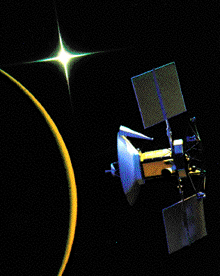 Because of Venus' thick cloud cover, the surface has only
recently been mapped out via radar measurements,
initially from Earth, and more recently by orbiters sent to
Venus.
The Magellan Mission
Using a sophisticated imaging radar, Magellan made the most
highly detailed surface maps of Venus from 1990 to 1994.
It was launched by the space shuttle Atlantis in 1989.
The decay (slowing) of the orbit due to friction in the outer
atmosphere brought the orbiter crashing to the hot surface
in October 1994.
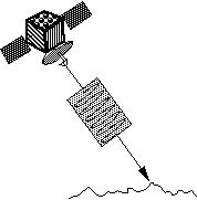
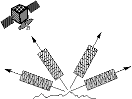
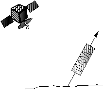
How Radar Works:
|
|
|
| Magellan sends light (radio wavelength) towards the surface. It does so at an angle (not directly down). Then it waits to see how much of that light is reflected back towards it. |
Rough Surface. A very rough surface will scatter the light in all directions, meaning a significant amount will scatter right back towards the orbiter, making the surface appear 'bright'. |
Smooth Surface. A smooth surface will scatter the light like a mirror. The light will bounce off at the same angle it came in. Little of the light will go directly back towards the orbiter, making the surface 'dark'. |
When we see radar images, remember:
- WHITE means ROUGH, DARK means SMOOTH.
Impact Craters
Large impact craters with diameters a few to 280 km
are visible in the fractured plains. Smaller craters are not
found since smaller meteorites never make it to the ground.
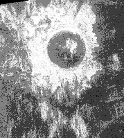
Typical crater features seen: rough radar-bright ejecta surrounds
the perimeter of the craters; terraced inner walls; and large central peaks.
Crater floors appear dark because they are smooth, flooded
by lava.
There are nearly 1000 evenly spaced (surface is all the same age) craters on Venus. The low number ages the current surface at 500 m.y.o. Since there is no weathering, it indicates there are global tectonics capable of restoring the entire surface.